TFR: Obama Visits the Bay Area

•October 22, 2010 • 1 Comment

Originally I had plans on making a post about Chandelles.I decided to post about something a little more relevant to today’s flight. Don’t get me wrong, we did Chandelles again, this is just more interesting. The much-anticipated Chandelle post will have to wait, sorry.

A TFR, or Temporary Flight Restriction, is a NOTAM (Notice to Airmen, pilots like acronyms huh?) which is regulatory in nature and restricts certain parts or specifies use of airspace. TFRs are issued for situations like airshows, firefighting, space operations, military operations, or, like today, to “protect the President, Vice President, or other public figures.” Just my luck.

This TFR meant a little more work for a simple training flight. The “inner core” of the TFR, situated around SFO, was restricted to all aircraft. Livermore was in the 30 nm radius outer core, which meant we could fly providing we met certain provisions. I had to file a flight plan to and from Livermore to get us outside the TFR to the central valley and maintain a specific squawk code in our transponder so ATC could easily identify us . We stayed in close contact the entire time with ATC. There is almost never a situation in which I don’t mind seeing fighter jets, EXCEPT when they are interested in me. Goal of the day for us and everyone else in the air: DO NOT BREAK TFR RULES; DO NOT GET INTERCEPTED BY FIGHTER JETS. Don’t believe me? It happened in Seattle not too long ago rocking the greater Seattle area with a sonic boom.

The TFR Map

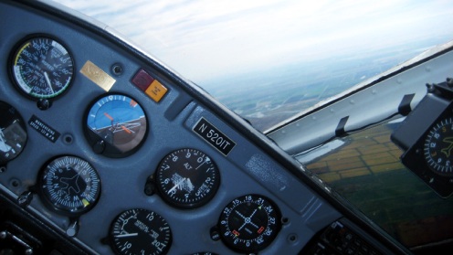
Once in the the practice area, safely outside the TFR, it was back to business as usual (besides staying in close contact with ATC for precautionary reasons). We did Steep Turns, Spiral-180 descents, Chandelles, various types of landings, and stalls. Fun stuff. I even managed to snap a few pictures of the Steep Turns while the instructor was at the controls.

Getting more comfortable with the maneuvers so next week will be adding more maneuvers to the menu: Lazy-Eights and Eights-on-Pylons.

Cross Country: LVK-RDD

•October 15, 2010 • 3 Comments

Every once and awhile there is a flight that is so amazing and incredibly beautiful that I have trouble coming up with the words to describe it. This flight topped all the others that have left me speechless in the past. Yes, I brought my camera. No, the pictures do not do justice.

First off, what the hell is a “cross country”? In aviation, a cross country flight is one in which a pilot uses navigation to land at an airport at least 50 nautical miles (nm) from the starting airport. For my commercial license I was required to have 2 hours of daytime cross country and 2 hours night cross country time to an airport at least 100 nm away with my flight instructor. We chose to head up to Redding. The goal was to fly two hours there during the day and two hours home at night.

It was a gorgeous autumn day, and a nice high pressure ridge meant it was hot (90 degrees) and clear! We set off from Livermore with our route taking us first to the Sacramento VOR, the Williams VOR, the Chico VOR, and direct to Redding.

For this flight we used an ATC service called “flight following.” When workload permits, ATC will give VFR (visual flight rules) traffic warnings to other traffic in the vicinity. It is a really helpful tool to keep situation awareness about the other aircraft sharing your airspace. Just past the SAC VOR we got an advisory to turn 30 degrees right to avoid a FedEx DC-10. The FedEx heavy got a similar vector to their right. The next picture has a little dot off the wingtip: that’s the FedEx heavy.

As we headed north the sun got lower and lower. To our right was the Sierra Nevada and the associated foothills. The western sides of the hills glowed orange and contrasted starkly with the long shadows off the eastern sides. We came into Redding at sunset. I think the sun actually set while on approach,  but I was busy and had more important things to pay attention to. In the distance the snow capped peak of Mt. Shasta glowed orange.

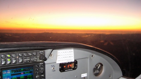
Our departure took us west instead of south. We had some time to kill so we climbed over the 8,000 foot peaks of the coastal mountain range towards Mendocino. Cruising at 8,500 feet we were treated to a brilliant orange and red glow over the pacific in the distance contrasted by the dark and misty mountain ranges below us.

The Pacific in the distance

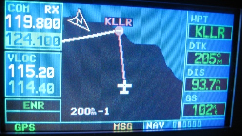
Our route programmed in the GPS

Our route then took us south over Santa Rosa into the spectacular sight of the Bay Area at night. The city, and the bridges, and the cars… its indescribable. We took the long way around Mt. Diablo because we needed a little more time to meet the requirements. We landed and called it a night.

Our route (click for large version)


There are no pictures of the night flying because the camera isn’t capable, hopefully someday I’ll have a better one that can help capture to absolute beauty of night flight. My instructor has been around the block, flying with two airlines previously before taking this job. He kept looking out the window and remaking how amazing and beautiful it was, almost mesmerizing. It doesn’t matter if it is your first flight or your 1,000th, it really never gets old.

Until next week…

Commercial License Continued..

•October 7, 2010 • 1 Comment

It has been awhile since I posted. Last week I only ended up flying once. I also keep forgetting to bring the camera OR to take pictures when I do bring it. I took some today, however.

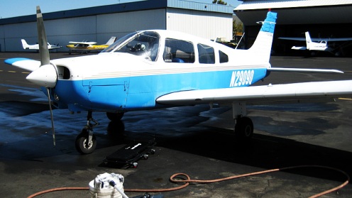
I finished my job plane washing. STILL waiting to see when I will get to work in the office. In the meantime, I’ll be picking up international students flying into SFO. Its a cool gig, .50 cents to the mile and the radio blasting make it fun.

My last flight was full of steep turns, short/soft field landings, and simulated engine failures. Today’s flight was full of steep turns, chandelles (explained in the next Commercial Maneuvers post), and simulated engine failures.

Today was the first frustrating day of my commercial training. It happens to every pilot and during every license, trust me. What causes it? Difficult weather, new airplane, stress or fatigue, being off your game, or a combination of factors. Today was a combination of new airplane and being off my game. I was flying the other Arrow on the flight line and was having all kinds of trouble landing/keeping the thing trimmed. Frustration in the cockpit can quickly build upon itself, causing one mistake to turn into many. On a positive note, I took some artsy black and white photos for your enjoyment.

Climbing out of LVK

Climbing out of Byron to LVK

Next week I need to accomplish a cross-country requirement: 2 hours of daytime flight 100 miles away and 2 hours of nighttime flight 100 miles away. I’ll be heading to Chico or some other place at least 100 miles away to accomplish this. One leg during the evening (day), one leg at night! I’ve missed night flying so much.

Till next week..

Commercial Maneuver: Steep Turns

•September 28, 2010 • Leave a Comment

Last week was kind of a bust.. 0/2 on the scheduled flights. One due to weather, the other because of a MIA instructor. I was hoping to do some sort of “photo blog,” but that will have to wait until later this week. I am flying twice this week (hopefully), including today, which is forecast to be 107 degrees.. Ouch!

As I progress through my commercial training I want to share, in detail, some of the maneuvers I’ll be doing. Last week we did Steep Turns, one of  my favorite maneuvers. To complete this maneuver successfully one must accomplish these goals:

  1. Establish the maneuvering speed, or Va
  2. Roll into a coordinated 360° steep turn with at least a 50° bank, followed by a 360° turn in the opposite direction
  3. Maintains the entry altitude ± 100 ft, airspeed ± 10 knots, bank ± 5°, and rolls out from the entry heading ± 10°

This maneuver requires  a lot of back pressure to keep the aircraft from losing altitude, using trim helps a ton to keep the nose up. At 60° bank the forces acting upon the aircraft are 2 Gs, so at 50° the forces are slightly less, but it is still quite noticeable.

Why is the maneuver necessary?  It helps the pilot learn how to control the aircraft near its maximum performance limits while successfully dividing attention between outside reference points and the instruments inside the aircraft. If you are having a bit of trouble envisioning what this looks like from the cockpit, here is a video of one done at 60° bank… and yes, it looks way cooler in real life.